Submissions
Allow registered users, or guests to create Maps from the front-end of your site.
You can control who can Submit Maps, what editor features are available and whether submissions should be approved before they are published.
Editor Features
The full Editor and Meta inputs are available.
Drawing
Drawing tools for Markers, Lines and Shapes. Each can be given a title, description, image and Type.
Types can be enabled for Submissions individually in Settings > [Markers/Lines/Shapes].
Photo Upload
Uploaded images are added to the WordPress Media Library and location meta data will be used if detected (EXIF).
Photos upload by guests can be stored separately from other Media Library uploads, to aid with moderation. If enabled, images uploaded by guests will be stored in a single directory found in the upload root (i.e. uploads/waymark_submission).
Read from File
GPX,KML and GeoJSON supported. Reading from file does not keep a copy of the file on the server.
Title
Allows the Map title to be set during Submission. If disabled a random title will be generated.
Meta
Submissions support Meta, whether an individual Meta input is displayed can be set in the Settings > Meta.
Settings
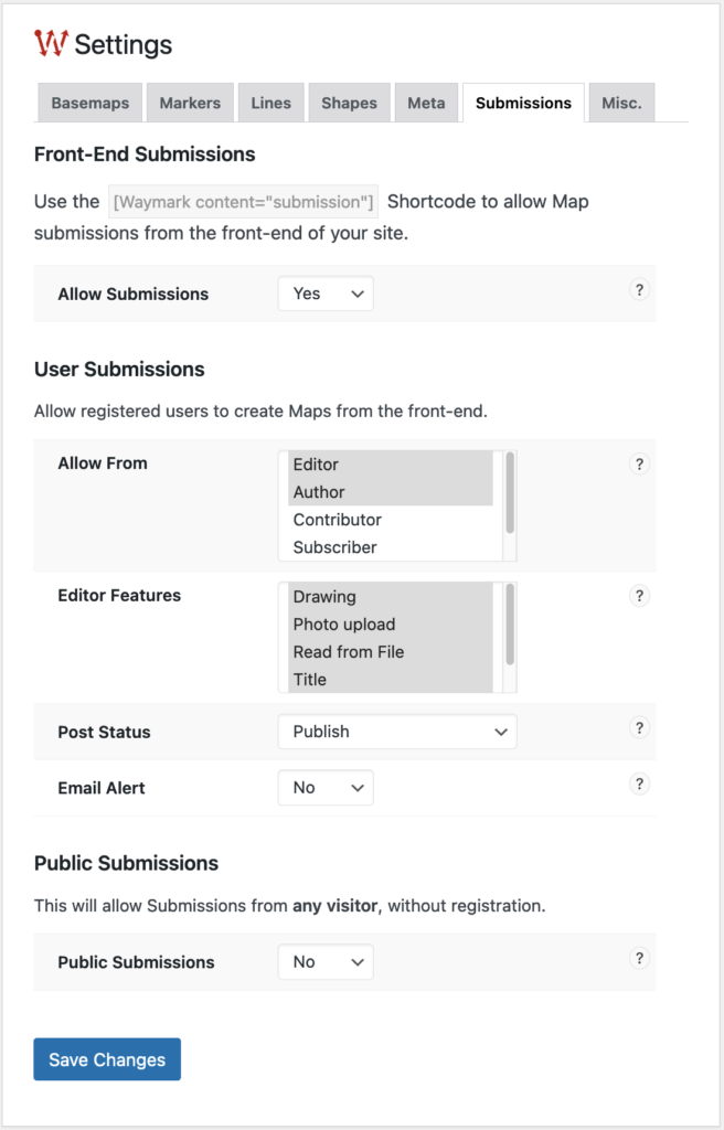
Submissions can be enabled and configured in Settings > Submissions.
Submissions can either by accepted from registered users (selectable by role) only, or publicly (i.e. no account necessary).
Settings are available for user submissions and public submissions separately.
Add to Your Site
Display using the Waymark Shortcode.
Waymark content="submission"Feedback
This feature was a large undertaking, so please let me know what you think by…
- Creating a new support topic on the WordPress plugin directory.
- Creating a GitHub issue.